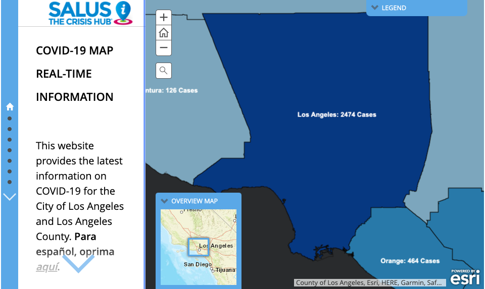
Pepperdine Homeland Security Advisory Council crisis map. (Photo: screen capture of the map)
Online Crisis Map For Los Angeles Region Created by Pepperdine Public Policy School
Homeland Security Institute crisis map has essential information on emergency food services, shelters, and statewide Case Tracker
By Katy Grimes, March 31, 2020 6:53 am
Pepperdine’s Homeland Security Institute has launched an online crisis map with essential information on emergency food services, shelters, and a statewide Case Tracker. Pete Peterson, Dean of Pepperdine’s Public School of Policy, said they’ve been working closely with Los Angeles and Orange County officials as well as the City of Los Angeles.
“A few years ago, they customized a mapping platform they call “SALUS,” the Roman goddess of safety and security, which has been used by LA City/County authorities to communicate with the public, and also to communicate internally in times of natural disasters,” Peterson said. “It has been used almost exclusively for fires here in the SoCal area – letting the public know where the evacuation areas are, along with safe evacuation routes, shelter locations, air quality, etc.”
With the COVID-19 pandemic, the team has been tasked with preparing a SALUS platform with various layers of information from caseloads to “Grab and Go” food locations. Peterson said the map is evolving, and will continue to add more pertinent information/locations as it comes from emergency ops planners in the region.
“It’s a great example of a public/private operation,” Peterson said. “Thus far we’re over 1.5 million public views on these maps.”
HSAC@SPP is a 501c3 and is completely supported by philanthropy. While the new maps have a statewide “Case Tracker” we’re also looking to promote the team’s work statewide, as we seek to support public safety folks all over the state…and beyond.

RELATED ARTICLES
-

-
 September 19, 2018
 -
 October 16, 2018


Good for Pepperdine — and good to know.
Love Pepperdine! All the LA area’s common sense resides there.